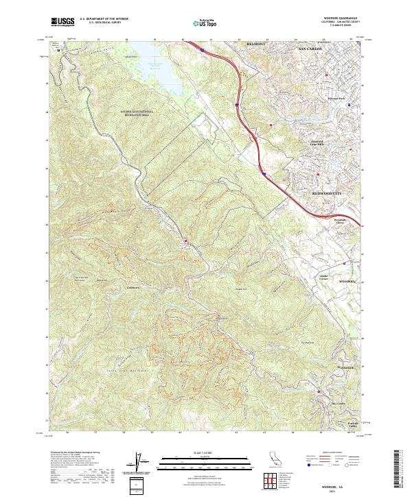
2021 Map of Woodside
USGS Topo · Published 2021About this map
The Santa Cruz Mountains dominate this landscape, where the ridges and gulches of the San Francisco Peninsula meet the suburban edge of the San Francisco Bay Area. The northern section is anchored by the Upper Crystal Springs Reservoir and the Golden Gate National Recreation Area, protecting the drainages of Mills Cr and Adobe Gulch. A complex network of trails, such as the Methuselah Trl and Giant Salamander Trl, weaves through the steep terrain between Irish Ridge and Durham Ridge. In the eastern foothills, the infrastructure of the Hetch Hetchy Aqueduct cuts through Emerald Lake Hills and Palomar Park. The map documents a transition from the dense residential planning of Redwood City and San Carlos to the larger estates and rural intersections of Adobe Corner and Sky Londa.
Find a feature on this map
210 named features on this map. Tap any name to fly to it.
Don’t see what you’re looking for? This feature index may not catch every label — zoom into the map to look around manually.
Map Details
Editions of this 2021 Woodside Map
This is the sole edition of this map. No revisions or reprints were ever made.
Other maps of this area

1892 · San Mateo
USGS Topo · 1:62,500

1896 · San Mateo
USGS Topo · 1:62,500

1897 · Palo Alto
USGS Topo · 1:62,500

1899 · Palo Alto
USGS Topo · 1:62,500

1899 · Haywards
USGS Topo · 1:62,500

1899 · San Mateo
USGS Topo · 1:62,500

1902 · Santa Cruz
USGS Topo · 1:125,000

1915 · San Mateo
USGS Topo · 1:62,500

1915 · Haywards
USGS Topo · 1:62,500

1939 · San Mateo
USGS Topo · 1:62,500