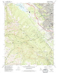
1991 Map of Woodside
USGS Topo · Published 1995About this map
The San Andreas Rift Zone carves a distinct path through this section of the Santa Cruz Mountains, framing the deep waters of the Upper Crystal Springs Reservoir and the Pulgas Water Temple. This landscape in the early 1990s reveals a sharp contrast between the dense residential expansion of Redwood City and San Carlos to the northeast and the preserved open spaces of Huddart County Park and Wunderlich County Park along the ridges. Local community life centers on small settlements like Woodside Glens and Sky Londa, with landmarks such as Sequoia Hospital and several neighborhood schools including Brittan Acres Sch serving the growing population.
Find a feature on this map
78 named features on this map. Tap any name to fly to it.
Don’t see what you’re looking for? This feature index may not catch every label — zoom into the map to look around manually.
Map Details
Editions of this 1991 Woodside Map
This is the sole edition of this map. No revisions or reprints were ever made.
Other maps of this area

1892 · San Mateo
USGS Topo · 1:62,500

1896 · San Mateo
USGS Topo · 1:62,500

1897 · Palo Alto
USGS Topo · 1:62,500

1899 · Palo Alto
USGS Topo · 1:62,500

1899 · Haywards
USGS Topo · 1:62,500

1899 · San Mateo
USGS Topo · 1:62,500

1902 · Santa Cruz
USGS Topo · 1:125,000

1915 · San Mateo
USGS Topo · 1:62,500

1915 · Haywards
USGS Topo · 1:62,500

1939 · San Mateo
USGS Topo · 1:62,500