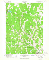
1966 Map of Woodstock North
USGS Topo · Published 1968About this map
The winding course of Barnard Brook and Pomfret Brook carves through the central highlands of Windsor County, connecting the small villages of Barnard, Pomfret, and South Pomfret during the mid-1960s. This survey captures a rural landscape where narrow valley roads like Stage Road and Cloudland Road follow the natural contours of the terrain, linking dispersed settlements such as East Barnard and Prosper. The Appalachian Trail traverses the southern ridges, passing near Atwood and Dana Hill, illustrating the region's long-standing role in New England backcountry recreation.
Find a feature on this map
47 named features on this map. Tap any name to fly to it.
Don’t see what you’re looking for? This feature index may not catch every label — zoom into the map to look around manually.
Map Details
Editions of this 1966 Woodstock North Map
3 editions found
Other maps of this area

1896 · Strafford
USGS Topo · 1:62,500

1906 · Hanover
USGS Topo · 1:62,500

1908 · Hanover
USGS Topo · 1:62,500

1911 · Woodstock
USGS Topo · 1:62,500

1913 · Woodstock
USGS Topo · 1:62,500

1919 · Royalton
USGS Topo · 1:62,500

1924 · Randolph
USGS Topo · 1:48,000

1926 · Randolph
USGS Topo · 1:62,500

1943 · Woodstock
USGS Topo · 1:62,500

1944 · Strafford
USGS Topo · 1:62,500