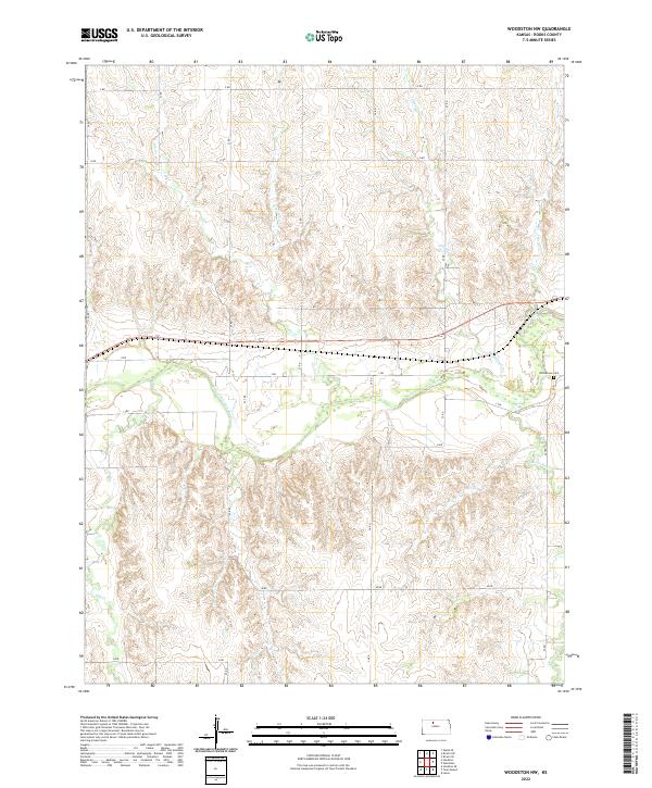
2022 Map of Woodston NW
USGS Topo · Published 2022About this map
The S Fork Solomon River defines the central valley of this Rooks County landscape, cutting a wide alluvial path through the rolling Kansas plains. Historically significant for its water access in an arid region, the river is fed by numerous seasonal drainages including Jim Cr, Douglas Cr, and Elm Cr. The human footprint is oriented around the sectional grid system, with roads like I RD and J RD providing access to the agricultural uplands. A primary point of interest for genealogists and local historians is Woodstown Cem, located in the eastern portion of the map near the border of t7s r16w. The terrain is characterized by the complex dendritic drainage patterns of Medicine Cr and Buros Cr, which have carved deep draws into the prairie, illustrating the transition from flat tabletop lands to the breaks of the Solomon River valley.
Find a feature on this map
23 named features on this map. Tap any name to fly to it.
Don’t see what you’re looking for? This feature index may not catch every label — zoom into the map to look around manually.
Map Details
Editions of this 2022 Woodston NW Map
This is the sole edition of this map. No revisions or reprints were ever made.
Other maps of this area

1893 · Phillipsburg
USGS Topo · 1:125,000

1896 · Plainville
USGS Topo · 1:125,000

1953 · Woodston NW
USGS Topo · 1:24,000

1953 · Stockton
USGS Topo · 1:24,000

1953 · Woodston
USGS Topo · 1:24,000

1955 · Beloit
USGS Topo · 1:250,000

1959 · Beloit
USGS Topo · 1:250,000

1961 · Kirwin SE
USGS Topo · 1:24,000

1961 · Kirwin SW
USGS Topo · 1:24,000
1972 · Glade SE
USGS Topo · 1:24,000