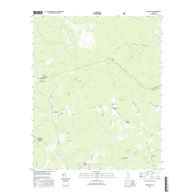
2017 Map of Woodville
USGS Topo · Published 2017About this map
Bairdstown and Woodville sit along the border of Greene and Oglethorpe counties in this survey of rural Georgia. The landscape is defined by the headwaters of the N Fork Little River and the S Fork Little River, which are fed by numerous smaller tributaries like Tuggle Cr and Hurricane Cr. Toward the south, the topography transitions into the Oconee National Forest, where features like the Broach Cem and Stewarts Lake are found tucked away from the main thoroughfares.
Find a feature on this map
72 named features on this map. Tap any name to fly to it.
Don’t see what you’re looking for? This feature index may not catch every label — zoom into the map to look around manually.
Map Details
Editions of this 2017 Woodville Map
This is the sole edition of this map. No revisions or reprints were ever made.
Other maps of this area

1906 · Crawfordville
USGS Topo · 1:125,000

1953 · Athens
USGS Topo · 1:250,000

1958 · Athens
USGS Topo · 1:250,000

1959 · Athens
USGS Topo · 1:250,000

1963 · Athens
USGS Topo · 1:250,000

1965 · Woodville
USGS Topo · 1:24,000

1965 · Union Point
USGS Topo · 1:24,000

1966 · Philomath
USGS Topo · 1:24,000

1966 · Crawfordville
USGS Topo · 1:24,000

1971 · Maxeys
USGS Topo · 1:24,000