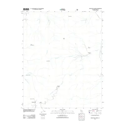
2012 Map of Woolstalf Creek
USGS Topo · Published 2012About this map
Moreland Mill anchors the southern portion of this high-altitude landscape in Kern County, marking a site of historic local industry near Mack Meadow. The terrain is defined by a network of drainage systems, including Woolstalf Cr and Kelso Cr, which carve through deep elevations like Bob Rabbit Canyon and Bear Trap Canyon. Several high-country meadows, such as Dry Meadows and Woolstalf Meadow, suggest a history of seasonal grazing or natural clearings among the peaks.
Find a feature on this map
26 named features on this map. Tap any name to fly to it.
Don’t see what you’re looking for? This feature index may not catch every label — zoom into the map to look around manually.
Map Details
Editions of this 2012 Woolstalf Creek Map
This is the sole edition of this map. No revisions or reprints were ever made.
Other maps of this area

1906 · Kernville
USGS Topo · 1:125,000

1908 · Kernville
USGS Topo · 1:125,000

1915 · Mojave
USGS Topo · 1:125,000

1943 · Cross Mountain
USGS Topo · 1:62,500

1943 · Emerald Mtn
USGS Topo · 1:62,500

1943 · Onyx
USGS Topo · 1:62,500

1943 · Isabella
USGS Topo · 1:62,500

1948 · Bakersfield
USGS Topo · 1:250,000

1955 · Bakersfield
USGS Topo · 1:250,000

1956 · Bakersfield
USGS Topo · 1:250,000