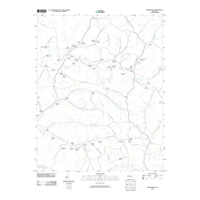
2010 Map of Woolworth
USGS Topo · Published 2010About this map
Whiteoak Creek and the North Fork Deer Creek carve through this Houston County landscape, defining a network of deep hollows that historically dictated settlement patterns. The map is a significant record for genealogists, documenting numerous family burial grounds including Lewis Cemetery, Cleghorn Cemetery, and Batson Cemetery. The terrain is characterized by descriptive landmarks like Deep Gut and Blowing Spring, alongside agricultural and industrial traces such as Limekiln Hollow and Grindstone Hollow. These names suggest a history of localized resource extraction and homesteading. Transportation is marked by traditional routes like Mail Rd and Woolworth Rd, which follow the winding ridges and valley floors between Big Richland Creek and the surrounding timbered heights.
Find a feature on this map
107 named features on this map. Tap any name to fly to it.
Don’t see what you’re looking for? This feature index may not catch every label — zoom into the map to look around manually.
Map Details
Editions of this 2010 Woolworth Map
This is the sole edition of this map. No revisions or reprints were ever made.
Other maps of this area

1931 · Erin
USGS Topo · 1:62,500

1936 · Gorman
USGS Topo · 1:24,000

1936 · Tantrough Hollow
USGS Topo · 1:24,000

1936 · Woolworth
USGS Topo · 1:24,000

1936 · Ruskin
USGS Topo · 1:24,000

1936 · Stewart
USGS Topo · 1:24,000

1936 · Halls Creek
USGS Topo · 1:24,000

1936 · Waverly
USGS Topo · 1:24,000

1936 · Tennessee City
USGS Topo · 1:24,000

1950 · Halls Creek
USGS Topo · 1:24,000