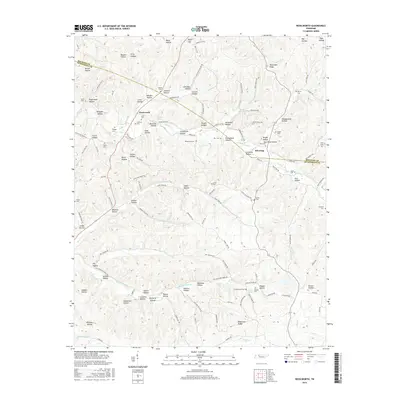
2016 Map of Woolworth
USGS Topo · Published 2016About this map
Woolworth and Silvertop anchor this rural landscape along the boundary of Houston County and Humphreys County. The terrain is defined by a dense network of named hollows, such as Shiloh Hollow, Mule Lot Hollow, and Deep Gut, which dictate the winding paths of local roads like Woolworth Rd. Significant for family historians, the area is dotted with small cemeteries including Cleghorn Cem, Sinks Cem, and Ridings Cem, often located near these topographic depressions.
Find a feature on this map
134 named features on this map. Tap any name to fly to it.
Don’t see what you’re looking for? This feature index may not catch every label — zoom into the map to look around manually.
Map Details
Editions of this 2016 Woolworth Map
This is the sole edition of this map. No revisions or reprints were ever made.
Other maps of this area

1931 · Erin
USGS Topo · 1:62,500

1936 · Gorman
USGS Topo · 1:24,000

1936 · Tantrough Hollow
USGS Topo · 1:24,000

1936 · Woolworth
USGS Topo · 1:24,000

1936 · Ruskin
USGS Topo · 1:24,000

1936 · Stewart
USGS Topo · 1:24,000

1936 · Halls Creek
USGS Topo · 1:24,000

1936 · Waverly
USGS Topo · 1:24,000

1936 · Tennessee City
USGS Topo · 1:24,000

1950 · Halls Creek
USGS Topo · 1:24,000