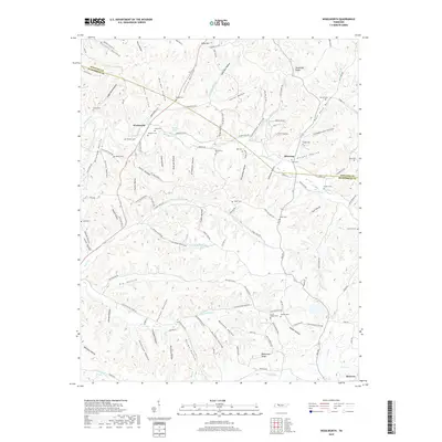
2019 Map of Woolworth
USGS Topo · Published 2019About this map
Tennessee Ridge serves as a prominent geographic divide in this section of Middle Tennessee, separating the watersheds of Whiteoak Cr and Big Richland Cr. The landscape is defined by an intricate network of narrow valleys, such as Brigham Hollow and Patterson Hollow, where generations of families established small farmsteads and cemeteries. Local history is deeply etched into the names of these hollows and the numerous family burial grounds like Batson Cem, Ridings Cem, and Ross Cem that dot the hillsides.
Find a feature on this map
129 named features on this map. Tap any name to fly to it.
Don’t see what you’re looking for? This feature index may not catch every label — zoom into the map to look around manually.
Map Details
Editions of this 2019 Woolworth Map
This is the sole edition of this map. No revisions or reprints were ever made.
Other maps of this area

1931 · Erin
USGS Topo · 1:62,500

1936 · Gorman
USGS Topo · 1:24,000

1936 · Tantrough Hollow
USGS Topo · 1:24,000

1936 · Woolworth
USGS Topo · 1:24,000

1936 · Ruskin
USGS Topo · 1:24,000

1936 · Stewart
USGS Topo · 1:24,000

1936 · Halls Creek
USGS Topo · 1:24,000

1936 · Waverly
USGS Topo · 1:24,000

1936 · Tennessee City
USGS Topo · 1:24,000

1950 · Halls Creek
USGS Topo · 1:24,000