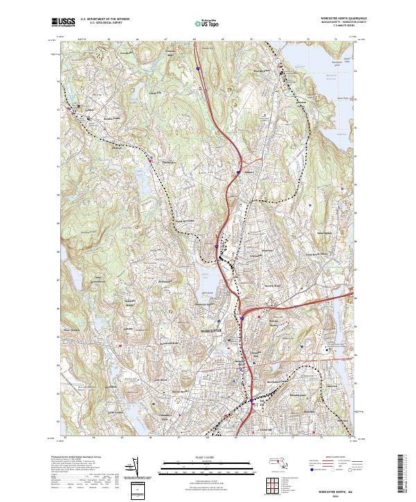
2024 Map of Worcester North
USGS Topo · Published 2024About this map
The industrial and institutional expansion of Worcester is clearly documented in this survey, showing a dense network of neighborhoods and landmarks that characterize the city’s northern reaches. From the academic grounds of Worcester Polytechnic Institute and Assumption College to the medical complex at the University of Massachusetts Medical School, the map illustrates a landscape shaped by higher education and healthcare. Settlement patterns extend outward into West Boylston and Holden, where historical locations like Canada Mills and Lovellville sit near the northern edge of the sheet.
Find a feature on this map
100 named features on this map. Tap any name to fly to it.
Don’t see what you’re looking for? This feature index may not catch every label — zoom into the map to look around manually.
Map Details
Editions of this 2024 Worcester North Map
This is the sole edition of this map. No revisions or reprints were ever made.
Other maps of this area

1885 · Worcester
USGS Topo · 1:62,500

1886 · Worcester
USGS Topo · 1:62,500

1886 · Blackstone
USGS Topo · 1:62,500

1887 · Marlboro
USGS Topo · 1:62,500

1889 · Marlboro
USGS Topo · 1:62,500

1889 · Blackstone
USGS Topo · 1:62,500

1889 · Webster
USGS Topo · 1:62,500

1892 · Webster
USGS Topo · 1:62,500

1892 · Worcester
USGS Topo · 1:62,500

1893 · Blackstone
USGS Topo · 1:62,500