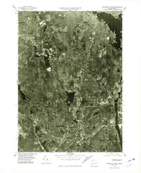
1975 Map of Worcester North
USGS Topo · Published 1981About this map
Worcester and its northern suburbs are captured in this mid-1970s orthophotograph, providing a detailed visual of the urban-to-rural transition. The landscape is dominated by the massive Wachusett Reservoir to the northeast and the elongated finger of Lake Quinsigamond to the southeast. These water bodies anchor the development of surrounding communities like West Boylston and Morningdale. Unlike traditional topographic maps, this aerial imagery reveals the density of residential clusters and industrial footprints in areas such as Chaffinville and Holden. The contrast between the densely built street grids of northern Worcester and the more wooded, sparsely settled sections near Jefferson illustrates the region's mid-century expansion. This record, produced by the Department of the Interior, offers researchers a clear view of the roadway networks and shoreline conditions before decades of subsequent development altered the local environment.
Find a feature on this map
9 named features on this map. Tap any name to fly to it.
Don’t see what you’re looking for? This feature index may not catch every label — zoom into the map to look around manually.
Map Details
Editions of this 1975 Worcester North Map
This is the sole edition of this map. No revisions or reprints were ever made.
Other maps of this area

1885 · Worcester
USGS Topo · 1:62,500

1886 · Worcester
USGS Topo · 1:62,500

1886 · Blackstone
USGS Topo · 1:62,500

1887 · Marlboro
USGS Topo · 1:62,500

1889 · Marlboro
USGS Topo · 1:62,500

1889 · Blackstone
USGS Topo · 1:62,500

1889 · Webster
USGS Topo · 1:62,500

1892 · Webster
USGS Topo · 1:62,500

1892 · Worcester
USGS Topo · 1:62,500

1893 · Blackstone
USGS Topo · 1:62,500