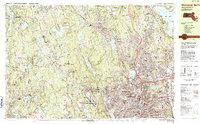
1983 Map of Worcester North
USGS Topo · Published 1984About this map
Worcester and its northern suburbs are documented in this detailed 1980s landscape, showing the city's transition from an industrial center to a hub of education and healthcare. The map captures prominent institutional grounds including Worcester Polytechnic Institute, Assumption College, and the sprawling Worcester State Hospital. To the west and north, the terrain rises into the hills of Paxton and Holden, where numerous water bodies like Holden Reservoir No. 1 and Eagle Lake dominate the geography.
Find a feature on this map
124 named features on this map. Tap any name to fly to it.
Don’t see what you’re looking for? This feature index may not catch every label — zoom into the map to look around manually.
Map Details
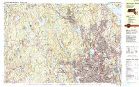
Editions of this 1983 Worcester North Map
2 editions found
Other maps of this area

1885 · Worcester
USGS Topo · 1:62,500

1886 · Worcester
USGS Topo · 1:62,500

1886 · Blackstone
USGS Topo · 1:62,500

1887 · Brookfield
USGS Topo · 1:62,500

1887 · Marlboro
USGS Topo · 1:62,500

1887 · Barre
USGS Topo · 1:62,500

1889 · Marlboro
USGS Topo · 1:62,500

1889 · Blackstone
USGS Topo · 1:62,500

1889 · Webster
USGS Topo · 1:62,500

1889 · Barre
USGS Topo · 1:62,500