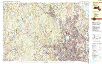
1983 Map of Worcester North
USGS Topo · Published 1991About this map
Worcester serves as the dense urban anchor of this central Massachusetts landscape during the early 1980s, showcasing a region defined by its prominent educational institutions and complex water management systems. The map captures a high concentration of higher education, including Anna Maria College, Assumption College, and Worcester Polytechnic Institute. Beyond the city limits, the terrain rises into the hills of Paxton and Holden, where a series of catchments like Holden Reservoir No. 1 and Kettle Brook Reservoir No. 4 feed the municipal supply. The northeastern corner is dominated by the Wachusett Reservoir, reflecting the historical engineering required to support the growing population. Rail infrastructure remains a vital element of the landscape, with the Boston and Maine and Providence and Worcester lines threading through the valley, while the Worcester Municipal Airport occupies the high ground on the western periphery.
Find a feature on this map
143 named features on this map. Tap any name to fly to it.
Don’t see what you’re looking for? This feature index may not catch every label — zoom into the map to look around manually.
Map Details
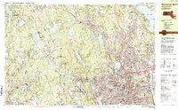
Editions of this 1983 Worcester North Map
2 editions found
Other maps of this area

1885 · Worcester
USGS Topo · 1:62,500

1886 · Worcester
USGS Topo · 1:62,500

1886 · Blackstone
USGS Topo · 1:62,500

1887 · Brookfield
USGS Topo · 1:62,500

1887 · Marlboro
USGS Topo · 1:62,500

1887 · Barre
USGS Topo · 1:62,500

1889 · Marlboro
USGS Topo · 1:62,500

1889 · Blackstone
USGS Topo · 1:62,500

1889 · Webster
USGS Topo · 1:62,500

1889 · Barre
USGS Topo · 1:62,500