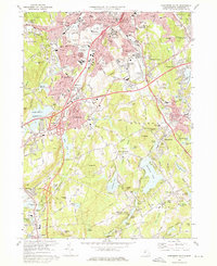
1973 Map of Worcester South
USGS Topo · Published 1976About this map
The industrial and academic landscape of Worcester dominates the northern section of this survey, where Holy Cross College and Clark University stand near established neighborhoods like Quinsigamond Village. The infrastructure of the early 1970s is clearly visible, with the Massachusetts Turnpike and Penn Central rail lines cutting through the terrain. To the south, the character of the land shifts toward the reservoirs and woods of Auburn and Millbury, anchored by water bodies such as Singletary Pond and Dark Brook Reservoir. Local genealogists will find significant value in the numerous burial grounds documented, including Hope Cemetery, the Swedish Cem, and St Johns Cemetery. Cultural landmarks of the era are preserved here as well, from the Auburn Mall to a Drive-in Theater and the Windle Airport, showing the post-war suburbanization surrounding the central city.
Find a feature on this map
124 named features on this map. Tap any name to fly to it.
Don’t see what you’re looking for? This feature index may not catch every label — zoom into the map to look around manually.
Map Details
Editions of this 1973 Worcester South Map
2 editions found
Other maps of this area

1885 · Worcester
USGS Topo · 1:62,500

1886 · Worcester
USGS Topo · 1:62,500

1886 · Blackstone
USGS Topo · 1:62,500

1887 · Marlboro
USGS Topo · 1:62,500

1889 · Marlboro
USGS Topo · 1:62,500

1889 · Blackstone
USGS Topo · 1:62,500

1889 · Webster
USGS Topo · 1:62,500

1892 · Webster
USGS Topo · 1:62,500

1892 · Worcester
USGS Topo · 1:62,500

1893 · Blackstone
USGS Topo · 1:62,500