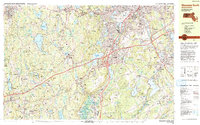
1983 Map of Worcester South
USGS Topo · Published 1984About this map
Clark University and Holy Cross College anchor the southern reaches of the city of Worcester, illustrating the academic and institutional footprint that defined the area in the early 1980s. This survey detail captures the convergence of major infrastructure, where the Massachusetts Turnpike meets the industrial corridors of the Conrail and Providence and Worcester railroads. The map reveals a transition from the dense urban neighborhoods of Quinsigamond Village and Stoneville into the fragmented landscapes of Auburn and Leicester.
Find a feature on this map
145 named features on this map. Tap any name to fly to it.
Don’t see what you’re looking for? This feature index may not catch every label — zoom into the map to look around manually.
Map Details
Editions of this 1983 Worcester South Map
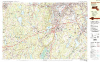
2 editions found
Other maps of this area

1885 · Worcester
USGS Topo · 1:62,500

1886 · Worcester
USGS Topo · 1:62,500

1886 · Blackstone
USGS Topo · 1:62,500

1887 · Brookfield
USGS Topo · 1:62,500

1887 · Marlboro
USGS Topo · 1:62,500

1887 · Barre
USGS Topo · 1:62,500

1889 · Marlboro
USGS Topo · 1:62,500

1889 · Blackstone
USGS Topo · 1:62,500

1889 · Webster
USGS Topo · 1:62,500

1889 · Barre
USGS Topo · 1:62,500