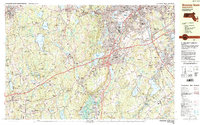
1983 Map of Worcester South
USGS Topo · Published 1984About this map
The Clara Barton Birthplace stands as a significant historical landmark in this region south of Worcester, where industrial corridors and suburban growth meet the wooded hills of central Massachusetts. The landscape is defined by the heavy infrastructure of the Massachusetts Turnpike and major interchanges that link Auburn, Millbury, and Oxford. While modern transit dominates the center, older patterns of settlement remain visible in the dense clusters of cemeteries like Hope Cemetery, Notre Dame Cemetery, and St Johns Cemetery, serving the diverse communities of Quinsigamond Village and Webster Square. Educational and religious institutions such as the College of the Holy Cross and St Josephs Ch occupy prominent positions near the city limits. Moving west toward Spencer and Leicester, the terrain shifts toward conservation lands like Spencer State Forest and numerous water bodies, including Stiles Reservoir and Cedar Meadow Pond, which supported earlier mill industries in villages like Rochdale and Cherry Valley.
Find a feature on this map
154 named features on this map. Tap any name to fly to it.
Don’t see what you’re looking for? This feature index may not catch every label — zoom into the map to look around manually.
Map Details
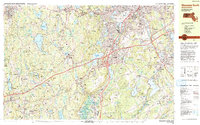
Editions of this 1983 Worcester South Map
2 editions found
Other maps of this area

1885 · Worcester
USGS Topo · 1:62,500

1886 · Worcester
USGS Topo · 1:62,500

1886 · Blackstone
USGS Topo · 1:62,500

1887 · Brookfield
USGS Topo · 1:62,500

1887 · Marlboro
USGS Topo · 1:62,500

1887 · Barre
USGS Topo · 1:62,500

1889 · Marlboro
USGS Topo · 1:62,500

1889 · Blackstone
USGS Topo · 1:62,500

1889 · Webster
USGS Topo · 1:62,500

1889 · Barre
USGS Topo · 1:62,500