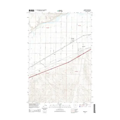
2014 Map of Worden
USGS Topo · Published 2014About this map
Worden and Ballantine serve as the primary population centers along this stretch of the Yellowstone River valley, where a grid of irrigation and transport infrastructure defines the landscape. The region's agricultural dependency is visible through the Huntley Canal Rd and Lower Canal Rd, which parallel the river's course to manage water distribution across the valley floor. To the south, the terrain rises sharply into the dissected uplands of Custer Coulee, contrasting with the orderly section-line roads like N 13th Rd and W I Rd that organize the lowlands. The central transport corridor is anchored by the Railroad Hwy, which connects the small settlement of Knox to the larger rail and highway network. This 2014 survey documents a mature irrigation district where modern rural development is still strictly guided by the historical township and range system.
Find a feature on this map
54 named features on this map. Tap any name to fly to it.
Don’t see what you’re looking for? This feature index may not catch every label — zoom into the map to look around manually.
Map Details
Editions of this 2014 Worden Map
This is the sole edition of this map. No revisions or reprints were ever made.
Other maps of this area

1893 · Huntley
USGS Topo · 1:125,000

1954 · Billings
USGS Topo · 1:250,000

1954 · Roundup
USGS Topo · 1:250,000

1956 · Huntley
USGS Topo · 1:24,000

1957 · Billings
USGS Topo · 1:250,000

1958 · Billings
USGS Topo · 1:250,000

1958 · Roundup
USGS Topo · 1:250,000

1967 · Nibbe
USGS Topo · 1:24,000

1967 · Worden
USGS Topo · 1:24,000

1967 · Cottonwood Creek
USGS Topo · 1:24,000