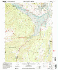
2001 Map of Workman Creek
USGS Topo · Published 2005About this map
The Rio Grande winds through high-altitude terrain in this 2001 revision of the Mineral County backcountry, illustrating a landscape defined by water and forest management. The area is heavily protected, dominated by the Weminuche Wilderness and the Rio Grande National Forest, where roadless expanses are only occasionally marked by human interventions. Trace the Stock Driveway as it follows Long Ridge, a remnant of the region's historic grazing routes. Geological interest is noted at the Sulphur Tunnel and a high-elevation Gravel Pit, while localized landmarks like the lone Cabin near Workman Creek and the Antelope Spring suggest the sparse, seasonal presence of foresters or ranchers. This map captures the complex drainage systems of the San Juan Mountains, from the headwaters of Trout Creek to the secluded Love Lake.
Find a feature on this map
32 named features on this map. Tap any name to fly to it.
Don’t see what you’re looking for? This feature index may not catch every label — zoom into the map to look around manually.
Map Details
Editions of this 2001 Workman Creek Map
This is the sole edition of this map. No revisions or reprints were ever made.
Other maps of this area

1905 · San Cristobal
USGS Topo · 1:125,000

1907 · San Cristobal
USGS Topo · 1:125,000

1914 · Creede
USGS Topo · 1:125,000

1916 · Creede
USGS Topo · 1:125,000

1945 · Durango
USGS Topo · 1:250,000

1953 · Durango
USGS Topo · 1:250,000

1954 · Durango
USGS Topo · 1:250,000

1957 · Spar City
USGS Topo · 1:62,500

1959 · Creede
USGS Topo · 1:62,500

1959 · Bristol Head
USGS Topo · 1:62,500