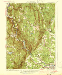
1942 Map of Woronoco
USGS Topo · Published 1942About this map
Westfield River carves a dramatic passage through the Berkshires, anchoring a landscape of industrial hamlets and highland farms just before the mid-century. The Boston and Albany Railroad tracks parallel the water, serving established mill communities such as Crescent Mills, Russell, and Woronoco. High above the river valley, the topography is punctuated by landmarks like Tekoa Mtn and Hosmer Lookout, while the rural interior near Montgomery reveals a network of local schools and churches, including the New State Sch and Montgomery Ch.
Find a feature on this map
83 named features on this map. Tap any name to fly to it.
Don’t see what you’re looking for? This feature index may not catch every label — zoom into the map to look around manually.
Map Details
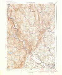
Editions of this 1942 Woronoco Map
2 editions found
Other maps of this area

1885 · Northampton
USGS Topo · 1:62,500

1886 · Springfield
USGS Topo · 1:62,500

1886 · Chesterfield
USGS Topo · 1:62,500

1886 · Northampton
USGS Topo · 1:62,500

1887 · Granville
USGS Topo · 1:62,500

1888 · Chesterfield
USGS Topo · 1:62,500

1889 · Springfield
USGS Topo · 1:62,500

1889 · Granville
USGS Topo · 1:62,500

1891 · Northampton
USGS Topo · 1:62,500

1893 · Northampton
USGS Topo · 1:62,500