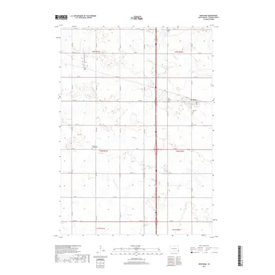
2017 Map of Worthing
USGS Topo · Published 2017About this map
Worthing anchors the eastern edge of this agricultural landscape in Lincoln County, South Dakota. The surrounding terrain is defined by a systematic network of section roads and drainage projects like Ditch Number 14 and Ditch Number Eight, reflecting the intensive land management required for prairie farming. This map is particularly valuable for genealogists, as it identifies several distinct burial grounds across the township, including Saint Edwards Cem, Mount Olivet Cem, and the West Prairie Lutheran Cem. Small water bodies such as Lake Albert and wandering streams like Beaver Cr and Snake Cr break up the rigid grid of the sections, marking the natural hydrology of the Great Plains before it gives way to the more developed corridors near Worthing.
Find a feature on this map
35 named features on this map. Tap any name to fly to it.
Don’t see what you’re looking for? This feature index may not catch every label — zoom into the map to look around manually.
Map Details
Editions of this 2017 Worthing Map
This is the sole edition of this map. No revisions or reprints were ever made.
Other maps of this area

1897 · Canton
USGS Topo · 1:125,000

1900 · Canton
USGS Topo · 1:125,000

1955 · Sioux Falls
USGS Topo · 1:250,000

1958 · Sioux Falls
USGS Topo · 1:250,000

1962 · Harrisburg
USGS Topo · 1:24,000

1962 · Tea
USGS Topo · 1:24,000

1962 · Lennox NW
USGS Topo · 1:24,000

1964 · Canton SW
USGS Topo · 1:24,000

1964 · Worthing
USGS Topo · 1:24,000

1964 · Lennox
USGS Topo · 1:24,000