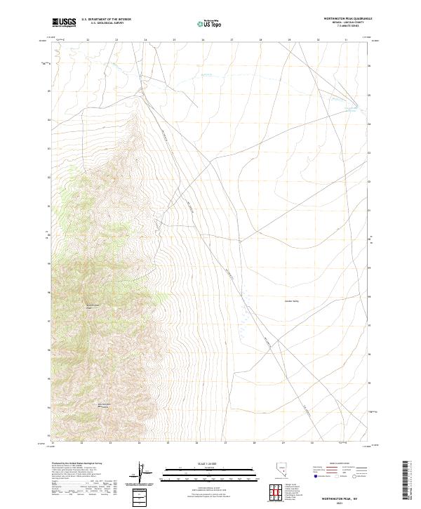
2021 Map of Worthington Peak
USGS Topo · Published 2021About this map
Worthington Peak dominates the western topography of this Lincoln County landscape, serving as a prominent high point within the Worthington Mountains. This high-desert terrain transitions abruptly into the broad expanse of Garden Valley, where the survey captures a characteristic Great Basin drainage pattern. Movement through this remote portion of Nevada is defined by Mail Summit Rd, which traverses the basin floor, likely following an established corridor for travel between ranges. Water resources are notably sparse, marked primarily by the seasonal flow of Barton Cr and the presence of the Cottonwood Reservoir in the northeastern corner. The map provides a detailed view of the Public Land Survey System grid, illustrating how township and range lines like t1n r57e were imposed upon this arid and sparsely settled environment.
Find a feature on this map
14 named features on this map. Tap any name to fly to it.
Don’t see what you’re looking for? This feature index may not catch every label — zoom into the map to look around manually.
Map Details
Editions of this 2021 Worthington Peak Map
This is the sole edition of this map. No revisions or reprints were ever made.
Other maps of this area

1942 · Penoyer Valley
USGS Topo · 1:125,000

1954 · Caliente
USGS Topo · 1:250,000

1956 · Lund
USGS Topo · 1:250,000

1959 · Caliente
USGS Topo · 1:250,000

1960 · Lund
USGS Topo · 1:250,000

1985 · Worthington Peak
USGS Topo · 1:24,000

1985 · McCutchen Spring
USGS Topo · 1:24,000

1985 · Murphy Gap
USGS Topo · 1:24,000
1985 · Badger Gulch
USGS Topo · 1:24,000

1985 · Worthington Peak SW
USGS Topo · 1:24,000