
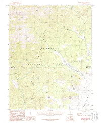
1985 Map of Worthington Peak
USGS Topo · Published 1986About this map
Worthington Mountains dominate the western portion of this mid-1980s provisional survey, rising sharply from the floor of Garden Valley. This landscape is defined by its mining history, with a concentration of industrial activity visible along the eastern slopes of the range near Worthington Peak. Prospectors and mining operations left a distinct mark here, evidenced by numerous Mine Shafts, Prospects, and Adits. The presence of Tailings and a Gravel Pit indicates a period of resource extraction that utilized the topography of the mountain front. Hydrological features are sparse in this high-desert environment, though drainage is marked by Barton Creek in the north, and a small Cottonwood Reservoir sits on the far eastern edge of the valley floor.
Find a feature on this map
18 named features on this map. Tap any name to fly to it.
Don’t see what you’re looking for? This feature index may not catch every label — zoom into the map to look around manually.
Map Details
Editions of this 1985 Worthington Peak Map
This is the sole edition of this map. No revisions or reprints were ever made.
Other maps of this area

1942 · Penoyer Valley
USGS Topo · 1:125,000

1954 · Caliente
USGS Topo · 1:250,000

1956 · Lund
USGS Topo · 1:250,000

1959 · Caliente
USGS Topo · 1:250,000

1960 · Lund
USGS Topo · 1:250,000

1985 · McCutchen Spring
USGS Topo · 1:24,000

1985 · Murphy Gap
USGS Topo · 1:24,000
1985 · Badger Gulch
USGS Topo · 1:24,000

1985 · Worthington Peak SW
USGS Topo · 1:24,000

1985 · Murphy Gap NW
USGS Topo · 1:24,000