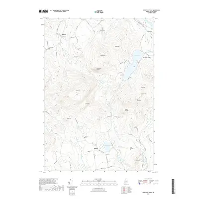
2021 Map of Worthley Pond
USGS Topo · Published 2021About this map
Worthley Pond and the surrounding peaks of Oxford County define this landscape, where early family names are preserved across numerous small burying grounds. The area is characterized by high terrain including The Saddleback, Tumbledown Dick Mtn, and Ragged Jack Mtn, which frame the deep valley of the East Branch Nezinscot River. Settlement is concentrated around the small village of Sumner and the historic community of Dickvale, where Stagecoach Rd and Mineral Springs Rd hint at the 19th-century transit and leisure economy of the region.
Find a feature on this map
85 named features on this map. Tap any name to fly to it.
Don’t see what you’re looking for? This feature index may not catch every label — zoom into the map to look around manually.
Map Details
Editions of this 2021 Worthley Pond Map
This is the sole edition of this map. No revisions or reprints were ever made.
Other maps of this area

1911 · Bryant Pond
USGS Topo · 1:62,500

1911 · Buckfield
USGS Topo · 1:62,500

1913 · Buckfield
USGS Topo · 1:62,500

1914 · Bryant Pond
USGS Topo · 1:62,500

1926 · Dixfield
USGS Topo · 1:62,500

1927 · Rumford
USGS Topo · 1:48,000

1929 · Dixfield
USGS Topo · 1:62,500

1930 · Rumford
USGS Topo · 1:62,500

1942 · Buckfield
USGS Topo · 1:62,500

1942 · Bryant Pond
USGS Topo · 1:62,500