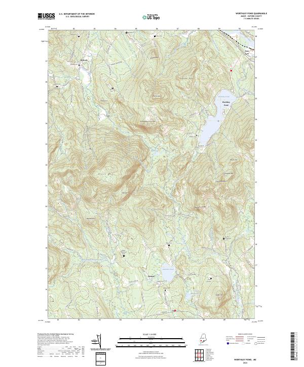
2024 Map of Worthley Pond
USGS Topo · Published 2024About this map
Sumner and Dickvale anchor this portion of Oxford County, where the landscape is defined by the headwaters of the West Branch Nezinscot River and Spears Stream. The terrain is marked by significant elevations including Black Mtn and Tumbledown Dick Mtn, while the recreational and residential focus centers on Worthley Pond. For genealogists and local historians, this survey is particularly valuable for its documentation of numerous family and community burial grounds, such as Dickvale Cem, Oldham Cem, and Keene Cem, many of which are situated along old rural routes like Morrill Farm Rd and Green Woods Rd. The map illustrates a classic Maine interior transition from valley settlements to upland forests, connected by a network of logging roads and historic corridors like Abbott Pond Rd.
Find a feature on this map
82 named features on this map. Tap any name to fly to it.
Don’t see what you’re looking for? This feature index may not catch every label — zoom into the map to look around manually.
Map Details
Editions of this 2024 Worthley Pond Map
This is the sole edition of this map. No revisions or reprints were ever made.
Other maps of this area

1911 · Bryant Pond
USGS Topo · 1:62,500

1911 · Buckfield
USGS Topo · 1:62,500

1913 · Buckfield
USGS Topo · 1:62,500

1914 · Bryant Pond
USGS Topo · 1:62,500

1926 · Dixfield
USGS Topo · 1:62,500

1927 · Rumford
USGS Topo · 1:48,000

1929 · Dixfield
USGS Topo · 1:62,500

1930 · Rumford
USGS Topo · 1:62,500

1942 · Buckfield
USGS Topo · 1:62,500

1942 · Bryant Pond
USGS Topo · 1:62,500