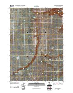
2011 Map of Wrangle Butte
USGS Topo · Published 2011About this map
Wrangle Butte and Chanis Rock define the high-desert landscape of this corner of Malheur County, Oregon. This 2011 survey illustrates a region largely defined by its water resources and sparse transit corridors. Water management for ranching or local use is evident through the presence of the Top Hat Reservoir, while natural water sources like Whiskey Springs, Tub Spring, and the branching drainage of Bull Creek indicate the vital points for survival and livestock in an arid environment. The primary thoroughfare through this territory is Tub Springs Rd, which navigates the undulating terrain toward Ryegrass Creek in the south. The map provides a precise look at the drainage patterns and topographical landmarks that have guided movement through this southeastern Oregon backcountry for generations.
Find a feature on this map
8 named features on this map. Tap any name to fly to it.
Don’t see what you’re looking for? This feature index may not catch every label — zoom into the map to look around manually.
Map Details
Editions of this 2011 Wrangle Butte Map
This is the sole edition of this map. No revisions or reprints were ever made.
Other maps of this area

1955 · Jordan Valley
USGS Topo · 1:250,000

1955 · Boise
USGS Topo · 1:250,000

1957 · Jordan Valley
USGS Topo · 1:250,000

1958 · Boise
USGS Topo · 1:250,000

1958 · Jordan Valley
USGS Topo · 1:250,000

1962 · Boise
USGS Topo · 1:250,000
1972 · Wrangle Butte
USGS Topo · 1:24,000
1972 · Saddle Butte
USGS Topo · 1:24,000

1972 · Owyhee Butte
USGS Topo · 1:24,000
1972 · Lambert Rocks
USGS Topo · 1:24,000