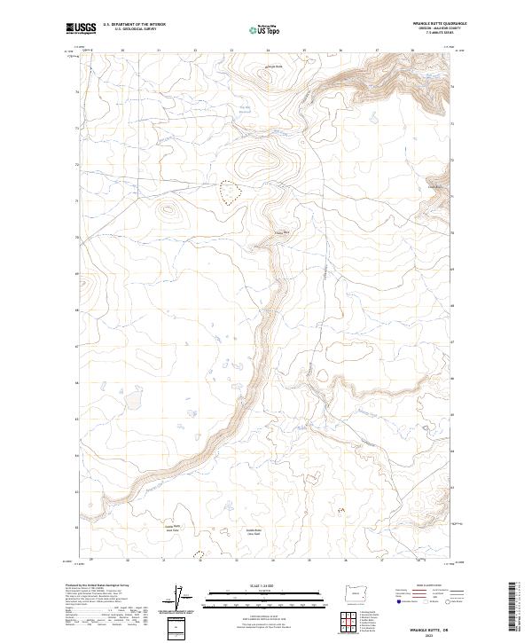
2023 Map of Wrangle Butte
USGS Topo · Published 2023About this map
Volcanic geology dominates this corner of Malheur County, where the Saddle Butte Lava Field and the Saddle Butte Lava Tube reveal the area's igneous origins. The landscape is defined by high desert features like Chanis Rock and the prominent Wrangle Butte, situated above a network of seasonal drainages. Water management in this arid environment is evidenced by the Top Hat Reservoir, while natural water sources appear as isolated points such as Whiskey Spring and Tub Spring. The map traces the winding course of Ryegrass Creek and Bull Creek, providing essential landmarks for navigation across the basin. The lone established route, Tub Springs Rd, connects these remote natural features, cutting through the high plateaus and passing the distinct Chalk Basin at the northeastern edge of the survey.
Find a feature on this map
17 named features on this map. Tap any name to fly to it.
Don’t see what you’re looking for? This feature index may not catch every label — zoom into the map to look around manually.
Map Details
Editions of this 2023 Wrangle Butte Map
This is the sole edition of this map. No revisions or reprints were ever made.
Other maps of this area

1955 · Jordan Valley
USGS Topo · 1:250,000

1955 · Boise
USGS Topo · 1:250,000

1957 · Jordan Valley
USGS Topo · 1:250,000

1958 · Boise
USGS Topo · 1:250,000

1958 · Jordan Valley
USGS Topo · 1:250,000

1962 · Boise
USGS Topo · 1:250,000
1972 · Wrangle Butte
USGS Topo · 1:24,000
1972 · Saddle Butte
USGS Topo · 1:24,000

1972 · Owyhee Butte
USGS Topo · 1:24,000
1972 · Lambert Rocks
USGS Topo · 1:24,000