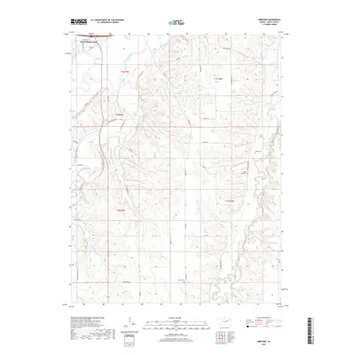
2018 Map of Wreford
USGS Topo · Published 2018About this map
Junction City anchors the northern edge of this Geary County landscape, situated where the Smoky Hill River winds through the tallgrass prairie. The terrain is defined by a dense network of drainages including Lyon Creek, Otter Cr, and Clarks Creek, which carve deep contours into the rolling hills south of the city. The small settlement of Wreford sits at a crossroads in the western portion of the sheet, reflecting the rural agricultural character of the region. Local history is preserved in several rural burial grounds such as Skiddy Cem, Wetzel Cem, and Salchow Cem, often located near early transportation routes like Old Stage Rd. The abundance of named roads, including Kickapoo School Rd and Skiddy West Rd, indicates a long-established pattern of section-line travel and land division.
Find a feature on this map
41 named features on this map. Tap any name to fly to it.
Don’t see what you’re looking for? This feature index may not catch every label — zoom into the map to look around manually.
Map Details
Editions of this 2018 Wreford Map
This is the sole edition of this map. No revisions or reprints were ever made.
Other maps of this area

1886 · Junction City
USGS Topo · 1:125,000

1889 · Junction City
USGS Topo · 1:125,000

1889 · Parkerville
USGS Topo · 1:125,000

1894 · Junction City
USGS Topo · 1:125,000

1894 · Parkerville
USGS Topo · 1:125,000

1947 · Manhattan
USGS Topo · 1:62,500

1947 · Fort Riley
USGS Topo · 1:62,500

1950 · Junction City
USGS Topo · 1:24,000

1950 · Alida
USGS Topo · 1:24,000

1951 · Ogden
USGS Topo · 1:24,000