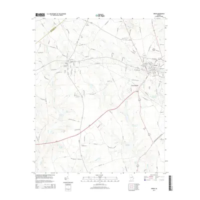
2014 Map of Wrens
USGS Topo · Published 2014About this map
The town of Wrens and nearby Stapleton anchor this Jefferson County landscape, where the regional topography is defined by the headwaters of numerous creeks and several established mill ponds. This area is characterized by a dense network of local family and community landmarks, including the Stone Springfield Cem and Harts Grove Cem. The presence of Wrens Memorial Airport and Wrens Station indicates the importance of transportation to the local economy, while water bodies such as Stapleton Mill Pond, Gamble Mill Pond, and Kings Mill Pond suggest a legacy of local milling and agriculture. The map also records the boundary line between Glascock and Jefferson counties, following the winding course of Duhart Cr through the western portion of the quadrangle.
Find a feature on this map
129 named features on this map. Tap any name to fly to it.
Don’t see what you’re looking for? This feature index may not catch every label — zoom into the map to look around manually.
Map Details
Editions of this 2014 Wrens Map
This is the sole edition of this map. No revisions or reprints were ever made.
Other maps of this area

1920 · Stapleton
USGS Topo · 1:62,500

1922 · Harlem
USGS Topo · 1:62,500

1948 · Harlem
USGS Topo · 1:62,500

1948 · Stapleton
USGS Topo · 1:62,500

1948 · Louisville
USGS Topo · 1:24,000

1950 · Louisville
USGS Topo · 1:24,000

1950 · Wrens
USGS Topo · 1:24,000

1950 · Matthews
USGS Topo · 1:24,000
1950 · Bowdens Pond
USGS Topo · 1:24,000

1950 · Kellys Pond
USGS Topo · 1:24,000