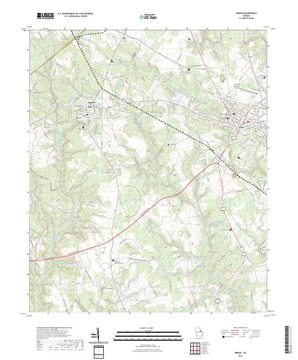
2024 Map of Wrens
USGS Topo · Published 2024About this map
The town of Stapleton serves as a primary hub in this Georgia landscape, defined by a network of agricultural lands and creek-fed ponds. The local topography is carved by waterways like Brushy Creek and Big Creek, which historically supported industry and recreation through features such as Stapleton Mill Pond, Gamble Mill Pond, and Kings Mill Pond. This 2024 map documents the enduring community structures of the area, notably the Stone Springfield AME Church and its associated Stone Springfield AME Church Cem, alongside several family and community burial grounds including Harts Grove Cem, Berryhill Cem, and Vining Cem. Moving east, the town of Wrens appears as a center of commerce and transport, anchored by its own Wrens Post Office and memorial sites. The map provides a contemporary view of the region's rural character, where small settlements remain tied to the surrounding drainage basins of Duhart Creek and Fishpond Branch.
Find a feature on this map
137 named features on this map. Tap any name to fly to it.
Don’t see what you’re looking for? This feature index may not catch every label — zoom into the map to look around manually.
Map Details
Editions of this 2024 Wrens Map
This is the sole edition of this map. No revisions or reprints were ever made.
Other maps of this area

1920 · Stapleton
USGS Topo · 1:62,500

1922 · Harlem
USGS Topo · 1:62,500

1948 · Harlem
USGS Topo · 1:62,500

1948 · Stapleton
USGS Topo · 1:62,500

1948 · Louisville
USGS Topo · 1:24,000

1950 · Louisville
USGS Topo · 1:24,000

1950 · Wrens
USGS Topo · 1:24,000

1950 · Matthews
USGS Topo · 1:24,000
1950 · Bowdens Pond
USGS Topo · 1:24,000

1950 · Kellys Pond
USGS Topo · 1:24,000