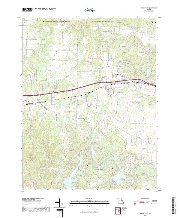
2021 Map of Wright City
USGS Topo · Published 2021About this map
Wright City and the expanding corridor along the Interstate 70 highway serve as the centerpiece of this Warren County landscape. The 2021 survey details a region characterized by private residential developments and recreational water bodies, particularly evident in the southern half of the map near Innsbrook. Numerous named ponds and lakes, such as Lake Scheffborg, Windy Knoll Lake, and Leprechaun Lake, indicate a topography reshaped for community and leisure use. For those tracing local heritage, the map identifies significant sites like the Harmonie Church Cem and Mount Airy Cem, while aviation interests are represented by the C E F Airport near the border of Warrenton. This modern record effectively contrasts the established agricultural heritage found at Poor Boy Ranch with the growing residential footprint of Hugh Manor.
Find a feature on this map
168 named features on this map. Tap any name to fly to it.
Don’t see what you’re looking for? This feature index may not catch every label — zoom into the map to look around manually.
Map Details
Editions of this 2021 Wright City Map
This is the sole edition of this map. No revisions or reprints were ever made.
Other maps of this area

1890 · Hermann
USGS Topo · 1:125,000

1903 · O'Fallon
USGS Topo · 1:125,000

1941 · Troy
USGS Topo · 1:62,500

1943 · Warrenton
USGS Topo · 1:62,500

1945 · Troy
USGS Topo · 1:62,500

1945 · Warrenton
USGS Topo · 1:62,500

1948 · Washington
USGS Topo · 1:62,500

1948 · Augusta
USGS Topo · 1:62,500

1949 · Saint Louis
USGS Topo · 1:250,000
1949 · Washington
USGS Topo · 1:62,500