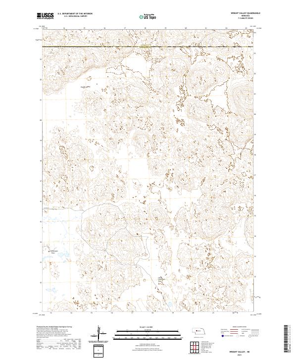
2021 Map of Wright Valley
USGS Topo · Published 2021About this map
Wright Valley characterizes this remote portion of the Nebraska Sandhills, located along the border of McPherson and Hooker counties. This 2021 survey illustrates a specialized landscape dominated by large topographic basins and flats, primarily the Big Lamunyon Flats and Little Lamunyon Flats in the southern portion of the quadrangle. The lack of traditional town sites or major infrastructure reflects the low-density grazing economy typical of this region. The map provides a precise layout of the Public Land Survey System, showing the transitions between t21n r34w, t20n r34w, and t19n r34w, which are essential for tracing land ownership and ranching heritage in these isolated sections of the plains.
Find a feature on this map
10 named features on this map. Tap any name to fly to it.
Don’t see what you’re looking for? This feature index may not catch every label — zoom into the map to look around manually.
Map Details
Editions of this 2021 Wright Valley Map
This is the sole edition of this map. No revisions or reprints were ever made.
Other maps of this area

1947 · Dismal River Ranch
USGS Topo · 1:62,500

1948 · Carr Lake
USGS Topo · 1:62,500

1949 · Dismal River Ranch
USGS Topo · 1:62,500

1949 · Flats
USGS Topo · 1:62,500

1949 · Wright Valley
USGS Topo · 1:62,500

1950 · Flats
USGS Topo · 1:62,500

1950 · Carr Lake
USGS Topo · 1:62,500

1951 · Wright Valley
USGS Topo · 1:62,500

1954 · North Platte
USGS Topo · 1:250,000

1956 · North Platte
USGS Topo · 1:250,000