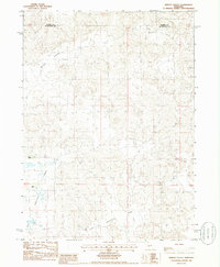
1985 Map of Wright Valley
USGS Topo · Published 1986About this map
Wright Valley defines the topographic character of this portion of the Nebraska Sandhills, where the landscape is marked by the unique depressional wetlands characteristic of the region. Surveyed in the mid-1980s, the map reveals the isolation and specialized land use of the border between Hooker and McPherson counties. The terrain is dominated by vast dune formations and intermittent water features, most notably the expansive Big Lamunyon Flats and the nearby Little Lamunyon Flats. Human presence is sparse, centered on established pastoral operations such as Huffman Ranch and Pettit Ranch. These family-named landmarks are critical for genealogists and local historians tracing the ranching heritage of the high plains, where specific homesteads often served as the primary geographical anchors for entire townships.
Find a feature on this map
6 named features on this map. Tap any name to fly to it.
Don’t see what you’re looking for? This feature index may not catch every label — zoom into the map to look around manually.
Map Details
Editions of this 1985 Wright Valley Map
This is the sole edition of this map. No revisions or reprints were ever made.
Other maps of this area

1947 · Dismal River Ranch
USGS Topo · 1:62,500

1948 · Carr Lake
USGS Topo · 1:62,500

1949 · Dismal River Ranch
USGS Topo · 1:62,500

1949 · Flats
USGS Topo · 1:62,500

1949 · Wright Valley
USGS Topo · 1:62,500

1950 · Flats
USGS Topo · 1:62,500

1950 · Carr Lake
USGS Topo · 1:62,500

1951 · Wright Valley
USGS Topo · 1:62,500

1954 · North Platte
USGS Topo · 1:250,000

1956 · North Platte
USGS Topo · 1:250,000