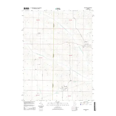
2014 Map of Wyaconda
USGS Topo · Published 2014About this map
Wyaconda sits at the heart of this landscape where the Scotland Co Clark Co line divides a network of rural settlements. The topography is defined by the winding paths of the Old Channel North Wyaconda River and Old Channel South Wyaconda River, suggesting a history of natural stream migration and hydraulic changes. To the north, the small towns of Granger and Luray are connected by Missouri State Highway 136, while Etna and its corresponding Etna Cemetery anchor the southwestern portion of the sheet. Genealogical value is found in the scattered rural burial grounds including Combs Cemetery near Luray and Blattner Cemetery just north of Wyaconda. Water features like Wyaconda City Lake and the smaller Railroad Lake reflect the infrastructure of the surrounding townships, while the naming of Tom Horn provides a specific local landmark amidst the creek-carved terrain of Little Wyaconda River.
Find a feature on this map
47 named features on this map. Tap any name to fly to it.
Don’t see what you’re looking for? This feature index may not catch every label — zoom into the map to look around manually.
Map Details
Editions of this 2014 Wyaconda Map
This is the sole edition of this map. No revisions or reprints were ever made.
Other maps of this area

1903 · Kahoka
USGS Topo · 1:125,000

1903 · Edina
USGS Topo · 1:125,000

1950 · Neeper
USGS Topo · 1:24,000

1950 · Medill
USGS Topo · 1:24,000

1950 · Colony
USGS Topo · 1:24,000

1951 · Colony
USGS Topo · 1:24,000

1951 · Neeper
USGS Topo · 1:24,000

1951 · Medill
USGS Topo · 1:24,000

1951 · Wyaconda
USGS Topo · 1:24,000

1954 · Centerville
USGS Topo · 1:250,000