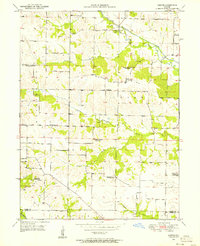
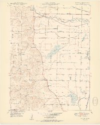
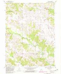
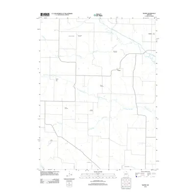
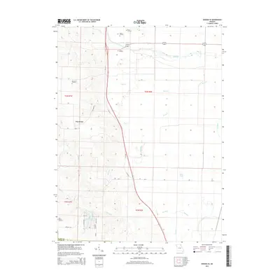
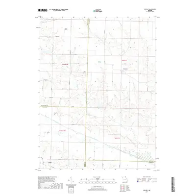
1950 Map of Neeper
USGS Topo · Published 1956About this map
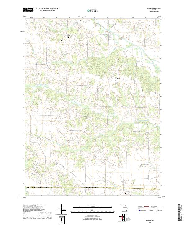
The Wyaconda River and its meandering tributaries, including the Little Wyaconda River and Hickory Creek, define the landscape of this corner of Clark County at the start of the 1950s. The map captures a rural social geography in transition, marked by a high density of small district schools that were already falling into disuse. Several of these landmarks, such as Union Sch and Brush College Sch, are explicitly noted as abandoned, signaling the mid-century shift away from localized country schoolhouses toward consolidated districts. Small crossroads like Neeper and Foree serve as the primary nodes for the surrounding farming community. Family history and early settlement patterns are preserved through features like the Schuster Cem and the Old German Cem, while the Liberty Ch remains a focal point for the Washington and Union townships.
Find a feature on this map
28 named features on this map. Tap any name to fly to it.
Don’t see what you’re looking for? This feature index may not catch every label — zoom into the map to look around manually.
Map Details
Editions of this 1950 Neeper Map
This is the sole edition of this map. No revisions or reprints were ever made.
Historical Maps of Neeper Through Time
30 maps found
1949 Kahoka SE
Clark County, MO
1949 St. Patrick
Clark County, MO
1950 Colony
Clark County, MO
1950 Kahoka SE
Clark County, MO
1950 Neeper
Clark County, MO
1950 St. Patrick
Clark County, MO
1951 Colony
Clark County, MO
1951 Neeper
Clark County, MO
1968 Anson
Clark County, MO
2010 Anson
Clark County, MO
2012 Anson
Clark County, MO

2012 Colony
Clark County, MO
2012 Kahoka SE
Clark County, MO
2012 Neeper
Clark County, MO
2012 Saint Patrick
Clark County, MO
2014 Anson
Clark County, MO
2014 Colony
Clark County, MO
2014 Kahoka SE
Clark County, MO
2014 Neeper
Clark County, MO
2014 Saint Patrick
Clark County, MO
2017 Anson
Clark County, MO
2017 Colony
Clark County, MO
2017 Kahoka SE
Clark County, MO
2017 Neeper
Clark County, MO
2017 Saint Patrick
Clark County, MO
2021 Anson
Clark County, MO
2021 Colony
Clark County, MO
2021 Kahoka SE
Clark County, MO
2021 Neeper
Clark County, MO
2021 Saint Patrick
Clark County, MO