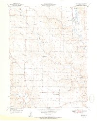
1951 Map of Benjamin
USGS Topo · Published 1951About this map
The rural landscape of Lewis County, Missouri, at the mid-century is defined by the winding course of the Wyaconda River and the smaller Little Sugar Creek and Sugar Creek. The settlement of Benjamin serves as a local node, while the surrounding townships of Lyon and Dickerson are dotted with family-named landmarks and rural institutions that suggest a deeply rooted agricultural community. The presence of numerous small schools, such as Allen Sch and Plano Sch, along with churches like Zion Hill Ch and Antioch Ch, indicates a decentralized social structure centered on local school districts and parishes before the era of widespread consolidation. Genealogy researchers will find significant value in the mapped cemeteries, including Hinton Cem, Graves Cem, and Patterson Cem, which anchor the land to the families who worked these fields. Small hamlets like Derrahs and features like the Rainbow Slough further distinguish the local geography of the day.
Find a feature on this map
30 named features on this map. Tap any name to fly to it.
Don’t see what you’re looking for? This feature index may not catch every label — zoom into the map to look around manually.
Map Details
Editions of this 1951 Benjamin Map
2 editions found
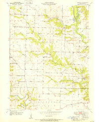
Other maps of this area

1903 · Kahoka
USGS Topo · 1:125,000

1949 · Kahoka SE
USGS Topo · 1:24,000

1949 · St. Patrick
USGS Topo · 1:24,000

1950 · Saint Patrick
USGS Topo · 1:24,000

1950 · Kahoka SE
USGS Topo · 1:24,000

1950 · Neeper
USGS Topo · 1:24,000

1950 · La Grange
USGS Topo · 1:24,000

1950 · Benjamin
USGS Topo · 1:24,000

1950 · Williamstown
USGS Topo · 1:24,000

1950 · Canton
USGS Topo · 1:24,000