
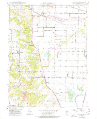
1949 Map of Kahoka SE
USGS Topo · Published 1963About this map
The Fox River and its intricate drainage network define the agricultural character of this Clark County landscape. Low-lying areas like Britton Prairie are managed by an extensive system of levees and a Pumping Station, indicating the local efforts to reclaim fertile bottomlands for farming. Settlement is anchored by the community of Winchester, while a dense grid of rural schools—including Mt Albia Sch, Plainview Sch, and Gravel Hill Sch—serves the surrounding farmsteads.
Find a feature on this map
28 named features on this map. Tap any name to fly to it.
Don’t see what you’re looking for? This feature index may not catch every label — zoom into the map to look around manually.
Map Details
Editions of this 1949 Kahoka SE Map
2 editions found
Other maps of this area

1903 · Kahoka
USGS Topo · 1:125,000

1936 · Keokuk
USGS Topo · 1:62,500

1946 · Mendon
USGS Topo · 1:62,500

1948 · Mendon
USGS Topo · 1:62,500

1949 · Wayland
USGS Topo · 1:24,000

1949 · Kahoka
USGS Topo · 1:24,000

1949 · St. Patrick
USGS Topo · 1:24,000

1950 · Kahoka
USGS Topo · 1:24,000

1950 · Saint Patrick
USGS Topo · 1:24,000

1950 · Kahoka SE
USGS Topo · 1:24,000