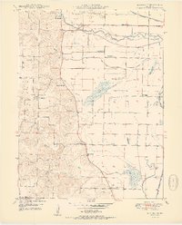
1950 Map of Kahoka SE
USGS Topo · Published 1950About this map
Britton Prairie and the low-lying wetlands of the Fox River valley dominate this corner of Clark County, as documented in 1950. The landscape is a study in early mid-century water management, featuring numerous levees and Pumping Stations designed to control the flow of Sugar Creek and Honey Creek. The small settlement of Winchester serves as a local hub, while the surrounding countryside is dotted with rural institutions that served the agricultural community, including Keystone Sch, Lone Star Sch, and Plainview Sch.
Find a feature on this map
26 named features on this map. Tap any name to fly to it.
Don’t see what you’re looking for? This feature index may not catch every label — zoom into the map to look around manually.
Map Details
Editions of this 1950 Kahoka SE Map
2 editions found

Other maps of this area

1903 · Kahoka
USGS Topo · 1:125,000

1936 · Keokuk
USGS Topo · 1:62,500

1946 · Mendon
USGS Topo · 1:62,500

1948 · Mendon
USGS Topo · 1:62,500

1949 · Wayland
USGS Topo · 1:24,000

1949 · Kahoka SE
USGS Topo · 1:24,000

1949 · Kahoka
USGS Topo · 1:24,000

1949 · St. Patrick
USGS Topo · 1:24,000

1950 · Kahoka
USGS Topo · 1:24,000

1950 · Saint Patrick
USGS Topo · 1:24,000