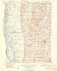
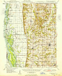
1948 Map of Mendon
USGS Topo · Published 1948About this map
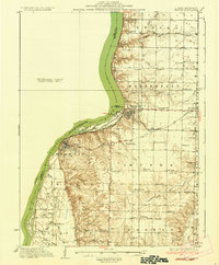
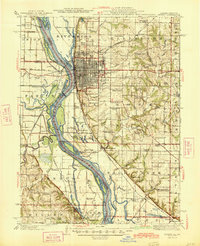
The Mississippi River creates a dynamic western boundary for this 1948 survey, where islands like Polly Island and Brownsville Island are separated from the Illinois mainland by channels such as Canton Chute and Flannigan Island Chute. The drainage of the lowlands is highly engineered, evidenced by the Rock and Ursa Creek Diversion Canal and several pumping stations near Indian Grave Lake. On the higher ground to the east, the landscape transitions into a dense network of early rural settlements and agricultural hubs, including Mendon, Ursa, and Lima. The survey captures an era of localized community life, recording numerous country schools like Indian Grave Sch and Brick Sch, alongside spiritual centers such as Mt Hebron Ch and Oak Valley Ch. Transportation is anchored by the Chicago Burlington and Quincy railroad, which parallels the river and connects the riverfront at Meyer to the inland prairies.
Find a feature on this map
108 named features on this map. Tap any name to fly to it.
Don’t see what you’re looking for? This feature index may not catch every label — zoom into the map to look around manually.
Map Details
Editions of this 1948 Mendon Map
2 editions found
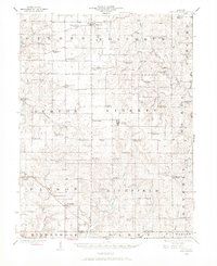
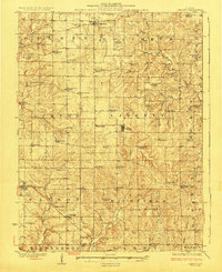
Other maps of this area

1903 · Kahoka
USGS Topo · 1:125,000

1903 · Palmyra
USGS Topo · 1:125,000

1925 · Quincy
USGS Topo · 1:62,500
1925 · Liberty
USGS Topo · 1:62,500
1927 · Liberty
USGS Topo · 1:62,500
1933 · Carthage
USGS Topo · 1:62,500
1936 · Keokuk
USGS Topo · 1:62,500
1937 · Carthage
USGS Topo · 1:62,500

1944 · Quincy
USGS Topo · 1:62,500
1945 · Quincy
USGS Topo · 1:62,500