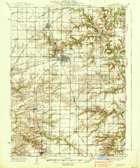
1933 Map of Carthage
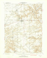
USGS Topo · Published 1965About this map
Carthage serves as the focal point of this Hancock County landscape, where the confluence of the Wabash and Quincy and Toledo Peoria and Western railroads established a vital agricultural transportation hub. The surrounding prairie is meticulously subdivided into townships like Pilot Grove and Bear Creek, dotted with an exceptionally dense network of early 20th-century rural schoolhouses including Young America School and Temperance School. A complex drainage system of natural waterways like Bear Creek and man-made improvements such as the Big Meadow Ditch underscores the region's transition from open prairie to productive farmland. Genealogists will find significant value in the recorded locations of the County Farm and numerous burial grounds like Moss Ridge Cemetery, which provide a clear spatial record of the community's early residents and social infrastructure.
Find a feature on this map
81 named features on this map. Tap any name to fly to it.
Don’t see what you’re looking for? This feature index may not catch every label — zoom into the map to look around manually.
Map Details
Editions of this 1933 Carthage Map
This is the sole edition of this map. No revisions or reprints were ever made.