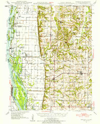
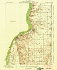
1946 Map of Mendon
USGS Topo · Published 1958About this map
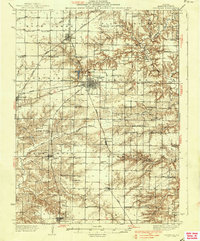
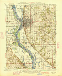
Mendon and the surrounding townships of Lima, Ursa, and Ellington are mapped here during a period of significant drainage modification and agricultural expansion. Along the eastern bank of the Mississippi River, an intricate system of levees and channels, including the Main Ditch, the Seepage Ditch, and the Rock and Ursa Creek Diversion Canal, illustrates the effort to reclaim fertile bottomlands like those near Indian Grave Lake. The landscape is dotted with small rural education centers such as Indian Grave Sch and Golden Sch, alongside community hubs like Hebron Ch. Transportation is defined by the Chicago Burlington and Quincy railroad line, which links the riverside town of La Grange with the interior settlements of Ursa and Mendon, while the Canton Ferry provides a vital river crossing to the Missouri side near Hardy Bar Island.
Find a feature on this map
101 named features on this map. Tap any name to fly to it.
Don’t see what you’re looking for? This feature index may not catch every label — zoom into the map to look around manually.
Map Details
Editions of this 1946 Mendon Map
This is the sole edition of this map. No revisions or reprints were ever made.
Other maps of this area

1903 · Kahoka
USGS Topo · 1:125,000

1903 · Palmyra
USGS Topo · 1:125,000

1925 · Quincy
USGS Topo · 1:62,500
1925 · Liberty
USGS Topo · 1:62,500
1927 · Liberty
USGS Topo · 1:62,500
1933 · Carthage
USGS Topo · 1:62,500
1936 · Keokuk
USGS Topo · 1:62,500
1937 · Carthage
USGS Topo · 1:62,500

1944 · Quincy
USGS Topo · 1:62,500
1945 · Quincy
USGS Topo · 1:62,500