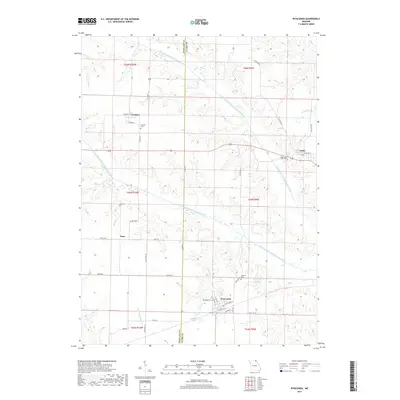
2017 Map of Wyaconda
USGS Topo · Published 2017About this map
The town of Wyaconda sits at the southern edge of this Clark County landscape, where the street grid of N Main St and W Madison St anchors a community defined by its proximity to the Little Wyaconda River. To the north, the terrain is shaped by the complex hydrology of the Old Channel North Wyaconda River and Old Channel South Wyaconda River, suggesting a landscape of former meanders and floodplains. Small settlements like Etna and Luray are connected by a network of state highways and local routes such as Seyb Tribe Rd and Foot Rd. Family and community history is preserved across the township in locations like Granger Cem, Etna Cem, and Blattner Cem. Water remains a central feature of the area, from the larger Wyaconda City Lake to smaller tributaries like Musko Br and Sand Br. The presence of Railroad Lake hints at the historical transit infrastructure that once helped move people and goods through this corner of Missouri.
Find a feature on this map
50 named features on this map. Tap any name to fly to it.
Don’t see what you’re looking for? This feature index may not catch every label — zoom into the map to look around manually.
Map Details
Editions of this 2017 Wyaconda Map
This is the sole edition of this map. No revisions or reprints were ever made.
Other maps of this area

1903 · Kahoka
USGS Topo · 1:125,000

1903 · Edina
USGS Topo · 1:125,000

1950 · Neeper
USGS Topo · 1:24,000

1950 · Medill
USGS Topo · 1:24,000

1950 · Colony
USGS Topo · 1:24,000

1951 · Colony
USGS Topo · 1:24,000

1951 · Neeper
USGS Topo · 1:24,000

1951 · Medill
USGS Topo · 1:24,000

1951 · Wyaconda
USGS Topo · 1:24,000

1954 · Centerville
USGS Topo · 1:250,000