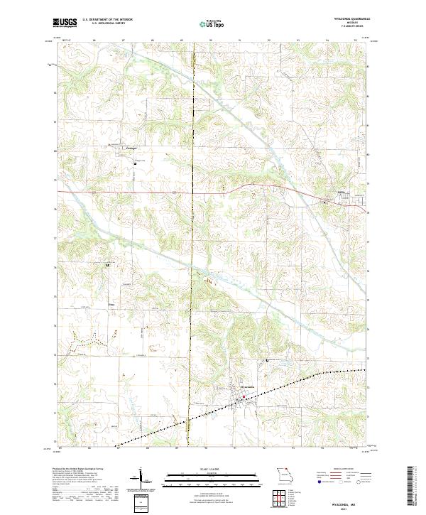
2021 Map of Wyaconda
USGS Topo · Published 2021About this map
Wyaconda sits at the intersection of State Hwy E and State Hwy W, serving as a central hub for this portion of the Clark Co and Scotland Co borderlands. The landscape is defined by the winding paths of the Old Channel North Wyaconda River and the Old Channel South Wyaconda River, whose meandering courses suggest a history of hydraulic shifts across the agricultural plains. Small communities like Granger, Luray, and Etna remain connected by a network of rural routes, including US Hwy 136. For those tracing local history, the map preserves the locations of several community burial grounds, such as Granger Cem, Combs Cem, and Etna Cem. Notable landmarks such as Tom Horn and the recreational Wyaconda City Lake provide specific geographic anchors within this Northeast Missouri terrain.
Find a feature on this map
44 named features on this map. Tap any name to fly to it.
Don’t see what you’re looking for? This feature index may not catch every label — zoom into the map to look around manually.
Map Details
Editions of this 2021 Wyaconda Map
This is the sole edition of this map. No revisions or reprints were ever made.
Other maps of this area

1903 · Kahoka
USGS Topo · 1:125,000

1903 · Edina
USGS Topo · 1:125,000

1950 · Neeper
USGS Topo · 1:24,000

1950 · Medill
USGS Topo · 1:24,000

1950 · Colony
USGS Topo · 1:24,000

1951 · Colony
USGS Topo · 1:24,000

1951 · Neeper
USGS Topo · 1:24,000

1951 · Medill
USGS Topo · 1:24,000

1951 · Wyaconda
USGS Topo · 1:24,000

1954 · Centerville
USGS Topo · 1:250,000