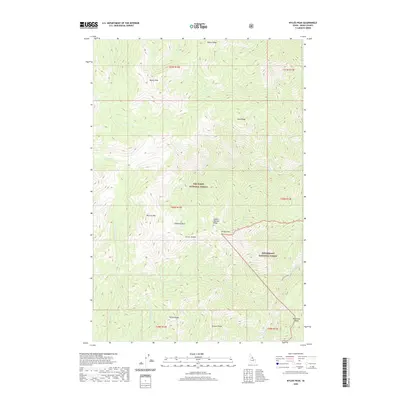
2020 Map of Wylies Peak
USGS Topo · Published 2020About this map
Wylies Peak stands as the central landmark of this high-elevation terrain within the Nez Perce National Forest and Bitterroot National Forest. The landscape is defined by a series of sharp ridges and deep creek drainages, including the prominent Wylies Ridge and Saddle Blanket Ridge. This 2020 survey details a vast network of watercourses such as Goat Cr, Grouse Cr, and the N Fork Goat Cr that carve through the mountain passes. Named peaks like Box Car Mtn, Diamond Rock, and Archer Mtn provide essential reference points for navigation through this wilderness. The intersection of different Forest Service administrative boundaries near Archer Saddle highlights the jurisdictional complexity of these protected lands, while features like Patrol Ridge suggest the history of forest management and fire lookout placement in Idaho County.
Find a feature on this map
34 named features on this map. Tap any name to fly to it.
Don’t see what you’re looking for? This feature index may not catch every label — zoom into the map to look around manually.
Map Details
Editions of this 2020 Wylies Peak Map
This is the sole edition of this map. No revisions or reprints were ever made.
Other maps of this area

1911 · Lolo
USGS Topo · 1:250,000

1913 · Lolo
USGS Topo · 1:250,000

1956 · Elk City
USGS Topo · 1:250,000

1956 · Hamilton
USGS Topo · 1:250,000

1959 · Hamilton
USGS Topo · 1:250,000

1960 · Elk City
USGS Topo · 1:250,000

1960 · Hamilton
USGS Topo · 1:250,000

1964 · Hamilton
USGS Topo · 1:250,000

1966 · Spot Mountain
USGS Topo · 1:24,000

1966 · Moose Ridge
USGS Topo · 1:24,000