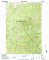
1995 Map of Wylies Peak
USGS Topo · Published 1999About this map
Wylies Peak dominates this high-elevation landscape within the northern Idaho interior, serving as a primary observation point with its noted Lookout. The area is defined by the convergence of three major federal land designations, where the Selway Bitterroot Wilderness meets the Nez Perce National Forest and the Bitterroot National Forest. Topography here is characterized by steep ridges and deep drainage systems, including Wylies Ridge and Goat Ridge, which shed water into the North Fork Clearwater River.
Find a feature on this map
24 named features on this map. Tap any name to fly to it.
Don’t see what you’re looking for? This feature index may not catch every label — zoom into the map to look around manually.
Map Details
Editions of this 1995 Wylies Peak Map
This is the sole edition of this map. No revisions or reprints were ever made.
Other maps of this area

1911 · Lolo
USGS Topo · 1:250,000

1913 · Lolo
USGS Topo · 1:250,000

1956 · Elk City
USGS Topo · 1:250,000

1956 · Hamilton
USGS Topo · 1:250,000

1959 · Hamilton
USGS Topo · 1:250,000

1960 · Elk City
USGS Topo · 1:250,000

1960 · Hamilton
USGS Topo · 1:250,000

1964 · Hamilton
USGS Topo · 1:250,000

1966 · Spot Mountain
USGS Topo · 1:24,000

1966 · Moose Ridge
USGS Topo · 1:24,000