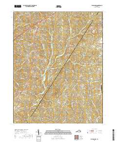
2019 Map of Wylliesburg
USGS Topo · Published 2019About this map
Wylliesburg serves as a central hub in this corner of southern Virginia, where rural roads converge at historic junctions. The landscape is defined by an intricate network of waterways, including the winding Bluestone Cr and its many tributaries like Otter Cr and Moody Creek. These streams carve through the countryside, dictating the placement of early settlements and family-named roads. Notable community landmarks such as Kings Crossroads and Philbeck Crossroads illustrate the traditional crossroads-centered development of Charlotte County. Genealogists will find value in the presence of local burial sites, including Black Branch Cem and Bethel Cem. While much of the area remains agricultural and residential, the southeastern corner is marked by modern infrastructure at the Chase City Municipal Airport.
Find a feature on this map
93 named features on this map. Tap any name to fly to it.
Don’t see what you’re looking for? This feature index may not catch every label — zoom into the map to look around manually.
Map Details
Editions of this 2019 Wylliesburg Map
This is the sole edition of this map. No revisions or reprints were ever made.
Other maps of this area

1941 · Clarksville
USGS Topo · 1:48,000

1943 · Clarksville
USGS Topo · 1:62,500

1953 · Greensboro
USGS Topo · 1:250,000

1954 · Greensboro
USGS Topo · 1:250,000

1954 · Clover
USGS Topo · 1:62,500

1955 · Chase City
USGS Topo · 1:62,500

1955 · Boydton
USGS Topo · 1:62,500

1957 · Clarksville
USGS Topo · 1:62,500

1962 · Greensboro
USGS Topo · 1:250,000

1966 · Greensboro
USGS Topo · 1:250,000