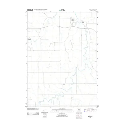
2011 Map of Wynot
USGS Topo · Published 2011About this map
Wynot and its surrounding agricultural landscape are defined by the winding course of Bow Creek and its several tributaries in Cedar County. This corner of northeast Nebraska preserves a high concentration of small-scale rural infrastructure, including the Wynot Post Office and the Cedar County Fairground to the southwest. The terrain is deeply etched by the waterway network, where West Bow Creek, East Bow Creek, and Dead Creek converge to create a complex drainage pattern through the section lines.
Find a feature on this map
21 named features on this map. Tap any name to fly to it.
Don’t see what you’re looking for? This feature index may not catch every label — zoom into the map to look around manually.
Map Details
Editions of this 2011 Wynot Map
This is the sole edition of this map. No revisions or reprints were ever made.
Other maps of this area

1955 · Sioux City
USGS Topo · 1:250,000

1958 · Sioux City
USGS Topo · 1:250,000

1959 · Sioux City
USGS Topo · 1:250,000

1968 · Obert
USGS Topo · 1:24,000

1968 · St. Helena
USGS Topo · 1:24,000

1968 · Coleridge
USGS Topo · 1:24,000

1968 · Hartington
USGS Topo · 1:24,000

1968 · Wynot
USGS Topo · 1:24,000
1968 · Meckling
USGS Topo · 1:24,000
1968 · Coleridge SE
USGS Topo · 1:24,000