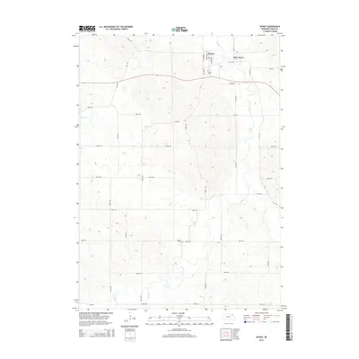
2014 Map of Wynot
USGS Topo · Published 2014About this map
Wynot and Saint James anchor this portion of Cedar County, where the northern Nebraska landscape is defined by the winding paths of several watercourses. The drainage of Bow Cr is central to the area, supported by tributaries including W Bow Cr, E Bow Cr, and Dead Cr. The settlement pattern follows a distinct grid of section roads like 891st Rd and 885th Rd, which connect these small rural communities. Local history and genealogy researchers will find several significant landmarks preserved on this 2014 survey, including Wynot Cem on the outskirts of the primary village and Paragon Cem located further south. The map illustrates a primarily agricultural region where the rolling terrain of the Missouri River valley bluffs begins to interact with the creek bottomlands.
Find a feature on this map
26 named features on this map. Tap any name to fly to it.
Don’t see what you’re looking for? This feature index may not catch every label — zoom into the map to look around manually.
Map Details
Editions of this 2014 Wynot Map
This is the sole edition of this map. No revisions or reprints were ever made.
Other maps of this area

1955 · Sioux City
USGS Topo · 1:250,000

1958 · Sioux City
USGS Topo · 1:250,000

1959 · Sioux City
USGS Topo · 1:250,000

1968 · Obert
USGS Topo · 1:24,000

1968 · St. Helena
USGS Topo · 1:24,000

1968 · Coleridge
USGS Topo · 1:24,000

1968 · Hartington
USGS Topo · 1:24,000

1968 · Wynot
USGS Topo · 1:24,000
1968 · Meckling
USGS Topo · 1:24,000
1968 · Coleridge SE
USGS Topo · 1:24,000