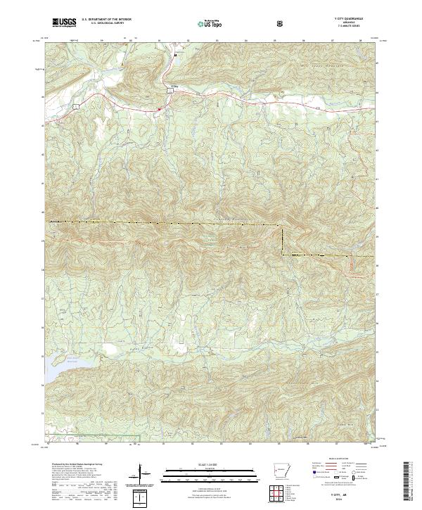
2024 Map of Y City
USGS Topo · Published 2024About this map
Y City sits at the junction of Us HWY 71 270 and Us HWY 270, serving as a central point for the surrounding highlands of the Ouachita National Forest. The landscape is dominated by high ridges including Mill Creek Mountain, Fourche Mountain, and Irons Fork Mtn, creating a series of deep valleys and hollows like Posey Hollow. Water from the northern slopes drains into the Fourche LaFave River, while the southern portion of the quadrangle is anchored by the Irons Fork Reservoir.
Find a feature on this map
40 named features on this map. Tap any name to fly to it.
Don’t see what you’re looking for? This feature index may not catch every label — zoom into the map to look around manually.
Map Details
Editions of this 2024 Y City Map
This is the sole edition of this map. No revisions or reprints were ever made.
Other maps of this area

1879 · Poteau Mountain
USGS Topo · 1:62,500

1887 · Poteau Mountain #1
USGS Topo · 1:62,500

1887 · Mount Ida #2
USGS Topo · 1:62,500

1890 · Mount Ida
USGS Topo · 1:125,000

1890 · Poteau Mountain
USGS Topo · 1:125,000

1899 · Poteau Mountain
USGS Topo · 1:125,000

1939 · Waldron
USGS Topo · 1:62,500

1940 · Waldron
USGS Topo · 1:62,500

1941 · Waldron
USGS Topo · 1:62,500

1949 · Waldron
USGS Topo · 1:62,500