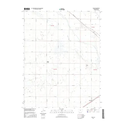
2015 Map of Yaggy
USGS Topo · Published 2015About this map
Yaggy and Whiteside anchor this western Reno County landscape, where the alluvial drainage of the Arkansas River basin defines the terrain. The area is characterized by a complex network of seasonal and perennial waterways, including Slough Cr, Dry Cr, and Salt Cr, which meander through a grid of section lines and rural avenues. These watercourses often intersect with prominent local roads such as Nickerson Blvd and Partridge Rd, illustrating the intersection of natural hydrology and the established township system. Near the center of the map, the small settlement at Adams Corner provides a historical point of reference for local researchers. The southern portion of the quadrangle is marked by Memorial Park Cem and the small station point of Whiteside, situated along the rail corridor. This survey offers a precise look at the rural infrastructure and land divisions in the heart of the Kansas plains during the mid-2010s.
Find a feature on this map
35 named features on this map. Tap any name to fly to it.
Don’t see what you’re looking for? This feature index may not catch every label — zoom into the map to look around manually.
Map Details
Editions of this 2015 Yaggy Map
This is the sole edition of this map. No revisions or reprints were ever made.
Other maps of this area

1889 · Cheney
USGS Topo · 1:125,000

1891 · Hutchinson
USGS Topo · 1:125,000

1891 · Cheney
USGS Topo · 1:125,000

1892 · Kingman
USGS Topo · 1:125,000

1893 · Hutchinson
USGS Topo · 1:125,000

1894 · Kingman
USGS Topo · 1:125,000

1894 · Lyons
USGS Topo · 1:125,000

1901 · Cheney
USGS Topo · 1:125,000

1955 · Wichita
USGS Topo · 1:250,000

1955 · Great Bend
USGS Topo · 1:250,000