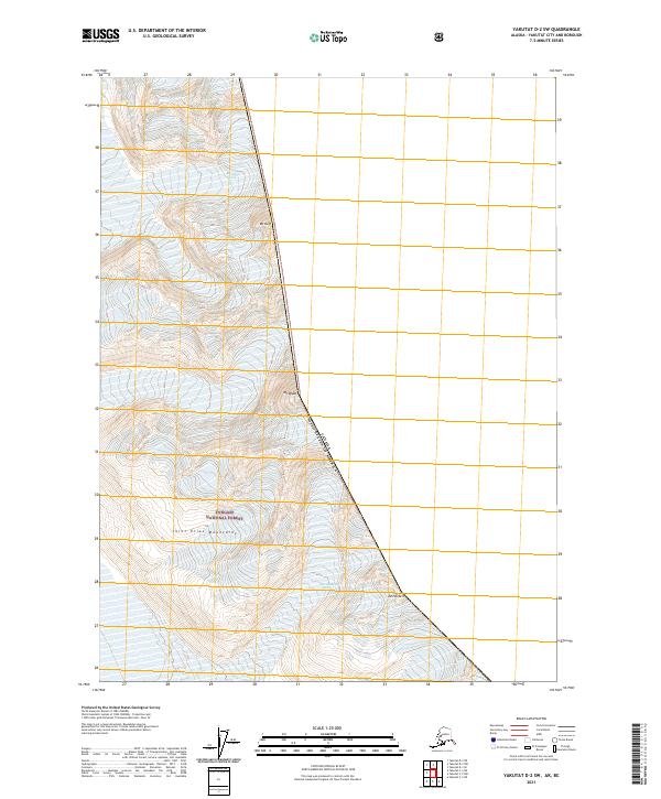
2021 Map of Yakutat D-2 SW
USGS Topo · Published 2021About this map
High peaks of the Saint Elias Mountains dominate this boundary region where the United States meets Canada. The landscape is defined by massive ice fields and moving ice, including McLewis Glacier and East Nunatak Glacier, which carve through the high-altitude terrain. Located within the Tongass National Forest, the area is characterized by extreme elevations and steep ridgelines, punctuated by prominent summits such as Mt Duff, Mt Wade, and Mt Herbert. This 2021 topographic record reveals a wilderness shaped entirely by glacial activity and tectonic uplift. The international border runs along a series of high points, creating a natural divide in a region where human infrastructure is entirely absent, leaving only the complex contours of the ice and rock to define the geography.
Find a feature on this map
13 named features on this map. Tap any name to fly to it.
Don’t see what you’re looking for? This feature index may not catch every label — zoom into the map to look around manually.
Map Details
Editions of this 2021 Yakutat D-2 SW Map
This is the sole edition of this map. No revisions or reprints were ever made.
Other maps of this area

1951 · Yakutat
USGS Topo · 1:250,000

1959 · Yakutat C-3
USGS Topo · 1:63,360

1959 · Yakutat D-3
USGS Topo · 1:63,360

1959 · Yakutat
USGS Topo · 1:250,000

1985 · Yakutat C-2
USGS Topo · 1:63,360
1985 · Yakutat D-2
USGS Topo · 1:63,360
2017 · Yakutat C-2 NE
USGS Topo · 1:25,000
2017 · Yakutat D-2 NW
USGS Topo · 1:25,000
2017 · Yakutat D-3 NE
USGS Topo · 1:25,000
2017 · Yakutat C-2 NW
USGS Topo · 1:25,000